|
A tour of the urban country lanes I found in South Birmingham.
Travelling across Birmingham the other week, I got diverted from my normal route home due to road works.
Not convinced that the diversion signs were sending me along the shortest alternative route I followed my own sense of direction and soon found myself on a single-track lane with soft verges and no street lighting.
But I hadn't discovered a shortcut into the countryside, what I had come across was one of the "urban country lanes" that are dotted around the Birmingham suburbs.
Knowing the location of several other "country" lanes within the city I decided to have a snoop around for others and was surprised to see how many I found.
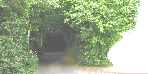
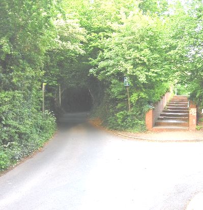
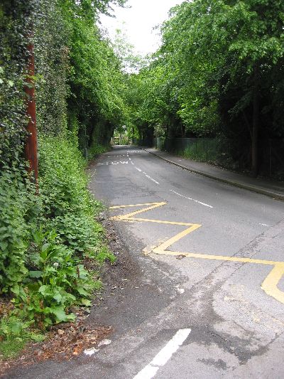
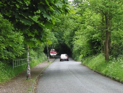
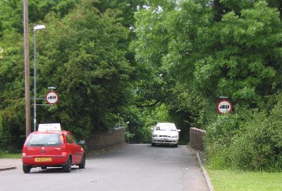
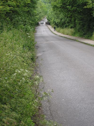
Despite its intimidating look, like the mouth of a dark tunnel, this road is surprisingly well used.
It is marked on the OS map as a yellow road(!) and I've yet to drive its whole length without encountering a vehicle coming in the opposite direction.
One thing you can't tell from the picture is how much the road twists as it climbs the hill, giving you little chance to see ahead.
No, wait, you can tell that from the map!
|
|
|
|
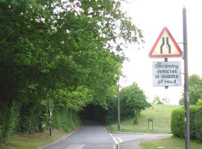
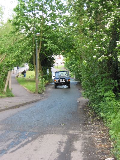
Directly on the other side of the valley from Merritts Hill is Bell Holloway.
A handy shortcut from the housing estate on Merritt's Brook to Northfield high street.
It's narrow, steep and dark.
There's a blue sign at the foot of the hill warning any HGV drivers who have successfully negotiated Merritts Hill not to attempt to go any further.
|
|
|
|
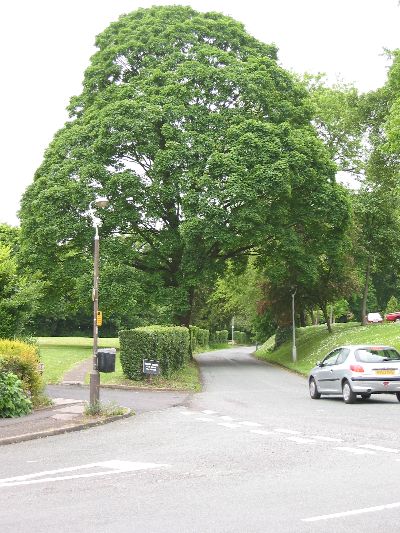
Starting on the A4040 outer ring road, this road weaves its way around St Peter's Church in the old Harbourne village.
The road doesn't look that narrow in the picture and even has a footpath on one side (pah!), but the sharp corners and overhanging trees play tricks on the senses.
|
|
|
|
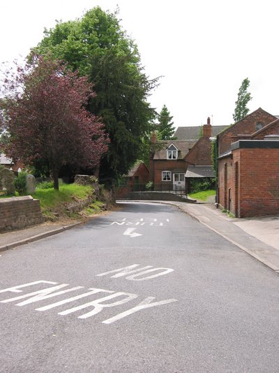
Here's a similar set-up in the old Northfield village. The village church is on the left and village pub just out of shot on the right.
The road weaves around the church grounds but this time is bordered by a dry-stone wall.
So, in an attempt to make the road safer, the council have made it one-way.
|
|
|
|
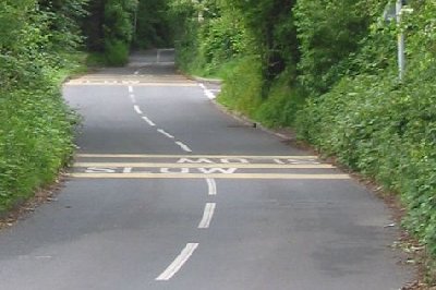
And here's another half-baked solution to the problem of narrow roads.
If you can't widen it, just paint it! Here the council have written the word "SLOW" on the tarmac every fifty yards and laid down some yellow rumble strips.
That should work.
Unfortunately they've also painted white lines down the centre, making the road look a lot wider than it actually is
(you can tell how narrow it is from the word SLOW, which straddles both lanes).
|
|
|
|
|
Cob Lane / Griffins Brook Lane,
Bournville
|
LOCATION
MAP
|
Just up the road from Hay Green Lane are Cob Lane and Griffins Brook Lane.
These lanes formed the original road network of Bournbrook's rural past.
When the Cadburys started to develop the area in 1895 the lanes were kept to link the new Bournville village to the main Bristol Road (A38) and act as a buffer, separating the houses from the busy highway.
Where houses were built the roads were widened, but towards the edge of the estate the roads are untouched and retain their rural feel.
|
|
|
|
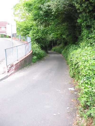
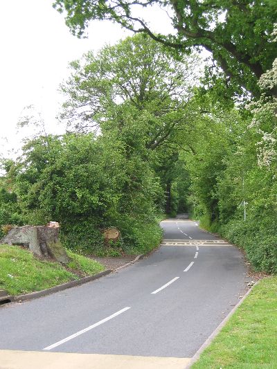
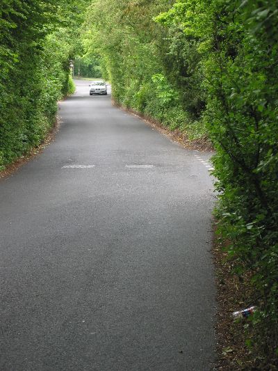
Another original country lane surviving on the Bournville estate is Hole Lane, which is a very useful and well-used shortcut through the A38-B4121-A4040 triangle.
Indeed, this is the road I found myself travelling along to avoid road works the other week.
|
|
|
|
This narrow lane, complete with ford, is just 2½ miles from the city centre.
I suspect the reason why this road has not been widened nor a bridge built may be to protect the residents on the west bank of the river:
this road is a handy cut-through but is (relatively) under used mainly because most people don't like the idea of driving through a ford.
Which is a pity because for town-tied 4x4s this is the closest thing they ever get to off-road.
|
|
|
|
There are a number of fords on the River Cole as it passes through south-east Birmingham.
Unfortunately the ford on Green Road is the only one still accessible by car.
Others have been removed or blocked off.
Here's the ford on Scribers Lane, a couple of miles upstream from Green Road.
Okay, looking at the size of this ford and knowing that the river is liable to flash floods, maybe closing this one was for the best.
|

|
|
|
Warstock Lane is sandwiched between Cocks Moor Golf Course and Cocks Moor Woods.
The road links the shops at Warstock to Kings Heath and is an alternative route to using the A435.
The original brick bridges over Chinn Brook and the Birmingham-Stratford canal are still in use, causing the road to narrow at both points.
The bridge over the canal is also a blind summit, just to make things more interesting.
|
|
|