What are LIMBs
LIMBs are Labels In the Map Border.
For years they have been used on paper maps to label roads as they leave the map. The labels often indicate the distance to the next town or city.
Interactive LIMBs
Maps are no longer static. Electronic maps can provide more than information. With electronic LIMBs you can also interact with features that are off the map.
This JavaScript library creates LIMBs for Google Maps that do just that.
Getting Started
Download the script from the SourceForge website.
Then import it into your page:
<script type="text/javascript" src="gmaplimbs-1.2-min.js"></script>
If you already have a Google Map that contains a google.maps.Marker
then you are one line of code away from tracking the marker in the map border.
Add this line of JavaScript to create the LIMB:
var myLimb = new lucid.maps.limbs.Limb( myMarker );
Examples
1: Return to Home
2: How to Find Us
3: Navigate Between Locations
4: Shapes
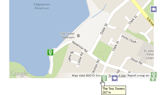
5: Google Places
Sites Using LIMBs
MapNav
MapNav is a navigation webapp for mobile.
The near-to-here feature displays places in user's vicinity. LIMBs are used to indicate places outside the map view.
View the Sitemiso
miso is a company that specialises in online GIS products and services.
The "contact us" section includes a Google Map that shows the most convenient transport links. LIMBs are used to indicate the direction of the nearest train stations and motorway junctions.
View the Site